Top tips for walking and hiking in Vaucluse
With the sun shining all year round, Vaucluse is the perfect place to enjoy picturesque walks and hikes, in winter as well as summer. For a stress-free day out, here are our top tips to bear in mind when preparing for a hike in the Luberon, around Avignon, on Mont Ventoux or along the Rhône Valley. This is an effective, though not exhaustive, checklist to run through before you set off – common sense should cover the rest.
5 things to do before setting off
1- Choose your route carefully
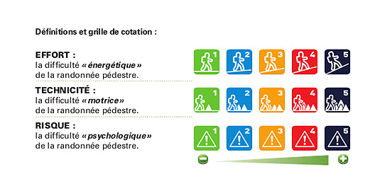
A route that is short in distance is not necessarily going to be an easy hike. The difficulty level indicated is based on several factors: effort (distance, elevation gain), the technicality of the route (terrain type, trail width, gravel, soil, sand…) and the risk level (cliffside passages, ladders …).
Please note: Vaucluse and its massifs boast a wide variety of geological features, including many calcareous, stoney and sandy areas – hiking terrain is often rocky!
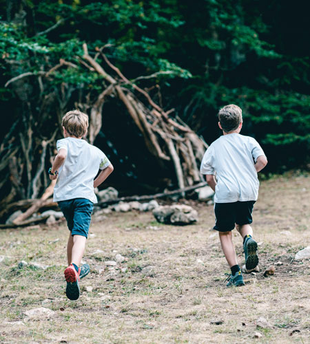
Choose a route which suits everyone:
– an adult hikes at an average speed of 3.5 km/hour
– children from 3 to 7 years old walk at an average pace of 1 to 2 km/hour and can walk roughly 1 km for every year of age
– 5 year olds can do a very easy walk (no technical difficulty, flat terrain) of up to 5 km
– children of 8 to 12 years can complete hikes between 10 and 15 km
2- Check the weather forecast
Just because it’s warm down there doesn’t mean it is warm up here!
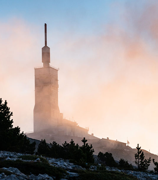
Mont Ventoux and the Luberon reach 1911 and 1125m in altitude respectively. In addition, the eastern part of the department – the Sault and Albion plateaus and the Monts de Vaucluse – are sometimes considered as part of the Prealps.
It is also a good idea to bear in mind that in these areas:
-The weather is constantly changing and it can vary between the foothills and the summit
-There are significant variations in temperature (from 5 to 15 degrees) between the plain, summit and plateaus.
Another unique feature of the Vaucluse region: the Mistral and its gusts! It is, in part, thanks to the Mistral that the sun shines the whole of winter, however, not only can it make you a bit chilly, but it can be dangerous along ridge walks.
To be specific, it feels 1° cooler for every 10 km/hour of wind, therefore if it is 10° with a 100 km/h wind, it will feel like 0°!
Check the weather forecast for Mont Ventoux: you can see the temperature and wind speeds at the top of the mountain
When is the best time to go hiking in Vaucluse?

Autumn, winter, spring
From the 15 September to the 30 May, it is often the perfect weather (between 18 and 25°C) in Vaucluse for a hike. Weeks of non-stop rain are rare, even in winter. Nevertheless, avoid climbing to the summit of Mont Ventoux in this season, as temperatures can drop to -10°C.

Summer:
In July and August, day hikes are strongly discouraged. Hiking itineraries and holidays are also to avoid during this period.
Between May and September, opt for short ½ day hikes, across a route where there is lots of shade or that is close to a body of water (the banks of the Rhône, the Durance or the Sorgue, or canals), subject to the conditions of access to the massif. We advise against visiting the Toulourenc valley at this time of the year. Early morning departures are advised.
> Check out the summer walks around Avignon
3 – Check whether you will be able to access the massifs of Vaucluse
Between the 15 June and the 15 September, the forests are closely monitored.
During this period, authorisation to access, move around and park in the Vaucluse forests is determined on a daily basis according to the level of risk, for all outdoor activities (climbing, horse riding, gravel and mountain biking, hiking etc.).
Fire risk levels are determined according to wind, plant dryness and air humidity.
From low, slight and moderate risk to severe risk: outdoor activites are authorised during the day in the Vaucluse forests and recommended in the morning due to the strong heat. These risks are displayed on a daily basis on the website in green and yellow.
If the risk level is very severe (red) or extreme (Red E), access to the Vaucluse forests is forbidden for all outdoor sports, including hiking. However, if the risk is very severe (red), groups supervised by a professional guide for outdoor activities (AMM), who have received DFCI training, can still hike.
These risk levels are set at 6 pm for the next day by a specialist Météo-France unit and are established by massifs and zones; a low to moderate risk in the Dentelles de Montmirail in no way means that it is the same in the Luberon.
To find out the access conditions to the different massifs for the next day, you have three possibilities. From 8 pm every day, you can:
– Consult the prefecture website
– Call the dedicated line: 04 28 31 77 11 (free of charge)
Please note: breaches of the conditions governing access to the forests are punishable by a fine of €750
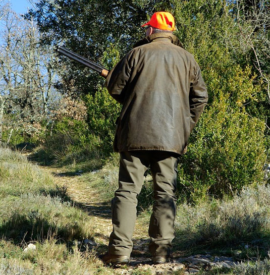
4- During the hunting season: wear bright colours!
From the start of September to the end of February, the space is shared with hunters
Hunting periods are set by the Vaucluse Prefecture and are necessary to maintain a healthy balance between flora and fauna and to limit damage to cultivated land and vines.
Hunters in each commune report and declare their hunts. You can also come across individual small game hunters, so you might want to dress in bright colours…
Check with your tourist office or local council to find out when hunting or hunting drives are taking place, so that you can avoid them.
Some communes establish days where hunting is not permitted. Here is a (non exhaustive) list of examples:
– Gigondas: hunting is not permitted on Wednesdays, Saturdays or Sundays from 13/10 to 09/01 > more information
– Beaumes de Venise: every Saturday and Sunday, from January onwards
– Sarrians: Hunting is not permitted (only on private land or fields only)
–Vacqueyras: Hunting is not permitted
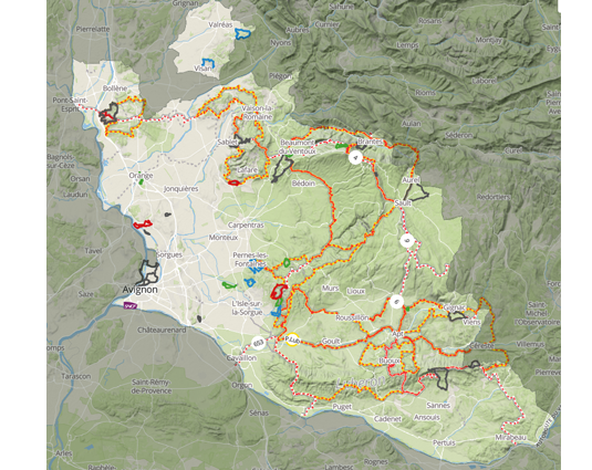
5- Choose your hike on a reliable website
These websites are worked on regularly by local authorities, the French Federation of Hiking in Vaucluse and its clubs, regional nature parks, and tourist offices, to preserve, maintain and mark out this wealth of footpaths:
Provenceguide.com, where you’ll find signposted routes around Vaucluse
Tools created by the French Federation of Hiking in Vaucluse:
– the Rando84 website
– topoguides
– the marando.com app
The Chemins des parcs website, edited by the regional nature parks of Mont Ventoux and the Luberon
IGN maps
Hiking etiquette
1- Keep to signposted trails
Here are a few useful tips to help you spot the footpath markings along your hike.
There are 4 types of signposting:
– GR® footpaths are “Grandes Randonnées” or long-distance hiking routes, proposed and maintained by the French Federation of Hiking, and are signposted in white and red. These major routes are linear, crossing the department to reach greater horizons.
– GR® Urbain V links Mont Lozère and Avignon.
– GR®653D links Montgenèvre and Arles, on the way to Saint Jacques de Compostelle, going via Domitienne and passing through the foothills of the Luberon.
– GR®9 links the department of Jura and the Mediterranean, crossing Vaucluse from north to south, via Mont Ventoux, the Vaucluse mountains and the Luberon.
– GR®4 links the Atlantic and the Mediterranean, passing through the Luberon, Mont Ventoux and the Rhône plain.
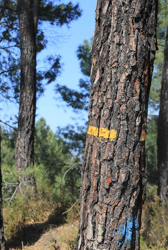
– GR® de Pays footpaths, proposed and maintained by the French Federation of Hiking, are signposted in yellow and red, and are routes spread across several days and loop back round, allowing you to explore a mountain range or a valley.
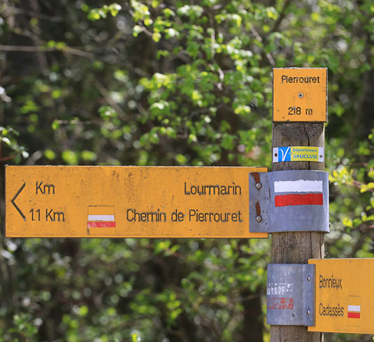
The different coloured signposts you’ll come across and what they mean
Routes marked out by yellow boards on wooden signposts are known as “Promenades et Randonnées” or PR – a tourist network made up of 1800 km of trails maintained by the department.
This network of trails can also be used for other outdoor activities, including mountain biking, trail running and horse riding, which has its own specific signposting.
During your day hikes, you will have to follow this signposting, which may be supplemented by paint markings, or even white/red and yellow/red signposting.
The hierarchy of markings is as follows: the GR® (white/red) dominates over the GR® de Pays (yellow/red), which in turn dominates over the PR (yellow). This means that the yellow markings may disappear at a junction and be replaced by other markings.
You will frequently come across a signpost indicating the possible directions, although we recommend you take a map (digital or paper) to help you find your way.
Vaucluse Provence Rando, Rando84 and Chemins des parcs trails use this trusted network.
You might come across some green markings, which will have been placed there by an association or local authority.

Report any faults along the route
To make sure you’re getting the best out of the department’s marked and maintained trails, we ask that you report any faults that you notice along the routes, so that managers will be directly informed of where and what the issue is (fallen wood, fly-tipping, lack of signposting etc.)
2- Respect private property
Respect private land – if access is physically closed off, don’t go through
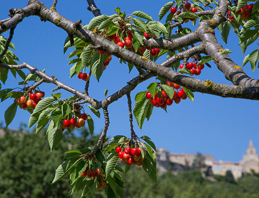
3- Do not help yourself to the fields
Picking is not permitted, even for a single grain, fruit or sprig.
To discover our many local agricultural products, make the most of your hike by stopping off at a nearby farm.
Farmers and foresters, shepherds, beekeepers, wine growers, livestock farmers, olive growers and truffle growers… these are the people who feed us and the places we walk are their workplaces. It is not up to them to adapt but to us, hikers and walkers, to respect the environment that we pass through.
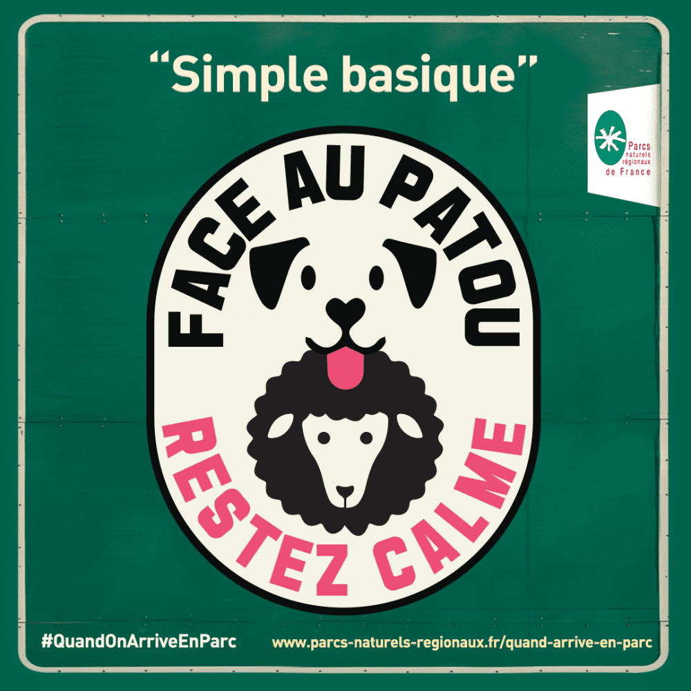
4- Adapt your behaviour if you come across a Patou (Pyrenean Mountain Dog)
With the wolf being present in the Vaucluse, farmers are helped by large dogs that keep watch over their flock of sheep, day and night. These protection dogs, known as Patous or Anatolian shepherds, are there to deter any intruders from approaching the flock by running and barking.
To prevent an incident with the protection dog, stay calm and passive, speak quietly, and keep your children at your side. Do not: make any sudden movements, kick or hit it with a stick, throw water or stones, look it in the eyes or feed it.
If you come across a pack, keep your distance, stop moving (so that the dogs can identify you) and do not threaten or stroke the guard dogs. Keep your childen by your side and your own dog on a lead (don’t hold him).
5- Share the space with others
Sharing the natural space with others: workers, hunters, mountain bikers, other walkers and local residents. During the period when hunting is permitted (September to the end of February), we advise you to stick to marked out trails, wear bright colours (a yellow, pink or orange jacket) and keep your dogs and children by your side. If you come across a hunt in progress or hunters, we advise you to make your presence clear and share with them your route, staying courteous and in a group.
6- Protect the nature by leaving it in peace
-Take your rubbish with you (even if it is “biodegradable”) when you stop for breaks and leave the spaces as you found them
– Don’t leave any human trace other than your footprints
– Respect the flora (no wild picking) and fauna (don’t make too much noise)
– Respect the silence of the space
-Don’t soil the waterholes, they are rare
-Don’t start a fire
– Keep to the routes suggested to you
– No driving or parking on the DFCI trails (Defence against forest fires) or in front of fire cisterns – they are reserved for emergencies
– No wild camping
– No smoking in the natural habitats
Useful links

Guide to hiking etiquette from the Mont Ventoux Regional nature park
The Toulourenc river : recommendations for a safe hike
Bivouac shelters
and wild camping
Bivouacking is when you set up a tent in the wild for a night, from sunset to sunrise.
The main rule to respect is to not leave any trace of your visit: fires are not permitted, take your rubbish with you and leave the space as you found it, or cleaner! Bivouacs may be more restricted or even prohibited in forests, woodlands, nature reserves, public roads and footpaths, within 500m of a listed monument or within 200m of a drinking water catchment.
Bivouacking is prohibited in urban zones or near roads.
Wild camping is when you stop for several days and nights, usually accompagnied by a motorised vehicle, in the middle of nowhere.

In a nutshell
Wild camping and bivouacking are prohibited from the 15 June to 15 September in the forests of Vaucluse. During the rest of the year, bivouacking is permitted from sunset to sunrise, except in restricted zones (Prefectoral Biotope Protection Order, Integral Biological Reserve), with the owner’s permission (if it is private property).
In Vaucluse, there are no grassland areas set aside for bivouacs in the Luberon. On Mont Ventoux, it is permitted in 2 zones – Jas Forest and Pavillon du Rat – provided you respect the rules regarding bivouacking. These sites are maintained by the Office National des Forêts.