Pays de Sault: The Three Villages Circuit
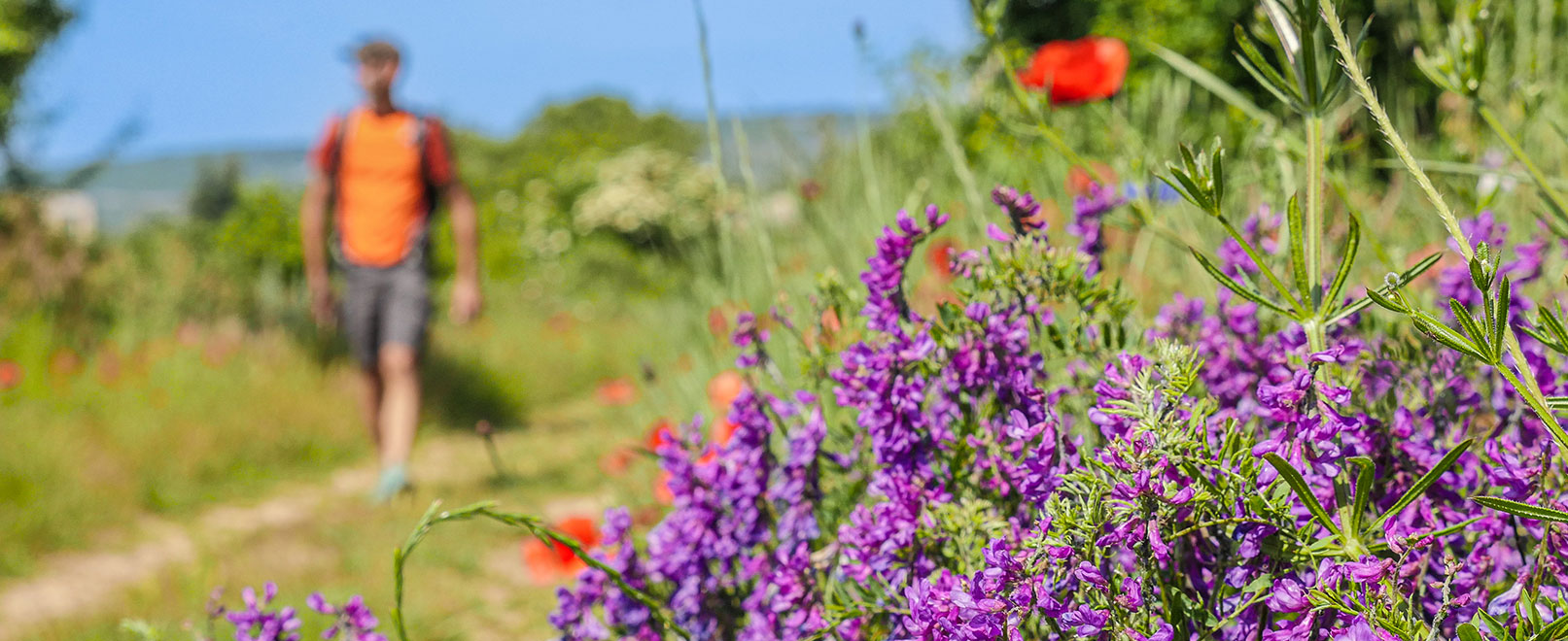
What if we turn away from Mont Ventoux at Sault? It is often the case that the eyes of visitors who come here turn towards the legendary Giant of Provence. Against the trend of conventional tourism, head for the wide open spaces which, from the north and east of Sault, rush towards the Plateau d’Albion. A series of paths form an almost perfect triangle which, crossing flowery undergrowth and lavender fields, links together other remarkable examples of mediaeval Provençal construction. Head for Saint-Trinit and then Aurel, in the land of lavender, to get behind the scenes of an intimate micro-universe which the impressive shadow of the Ventoux often tends to hide in spite of itself.
Duration:
2 hour
Type:
Hiking
Lavender & Mont-Ventoux
From Sault to Saint-Trinit
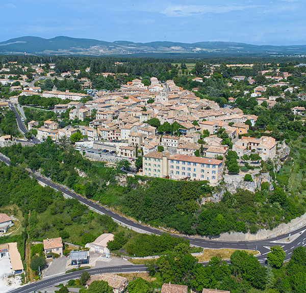
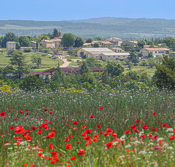
On its robust promontory, Sault dominates its little world of lavender, einkorn and wheat. You might be drawn into narrow streets that seem unchanged since the time when the d’Agoult family reigned over the entire territory. Then, along generously flowered paths, you can enjoy its lavender hinterland, watched over by the massive silhouette of Mont Ventoux to the west. Further north are the Baronnies Provençales and the Montagne d’Albion, renowned sentinels behind the protection of which the Pays de Sault passes a peaceful existence. Then, beyond a horizon of poppies, the facades of the houses of Saint-Trinit appear.

Practical Information
Marked by studs on the ground in the image of a wolf – the symbol of Sault’s coat of arms – the discovery circuit “One Hour in the Wolf’s Footsteps” allows you to explore the history of the old village of Sault. Depart from in front of the Tourist Office, on the esplanade of the Promenade.
In the Shade of the Woodland
Practical Information
For a lunch break, why not sit at Anthony and Élodie’s table at the Bistrot de Pays de Saint-Trinit? In a warm and friendly atmosphere, you can enjoy good dishes based on locally-sourced produce.
From Saint-Trinit to Aurel
Saint-Trinit is home to a 12th-century church, a beautiful expression of Romanesque art in Provence. It is a more compact town than Sault, but the ochre-coloured stone makes it warm, suggesting that you should linger there longer than you bargained for. In July and August, lavender producers can be seen here, coming and going to deliver the precious flowers to the distillery. Further on, the Barrulé valley marks the beginning of a shady section, between chestnut and coniferous trees. Beyond Marquisan, the forest becomes more sparse and the horizon regains momentum, allowing the gaze to rise again to the wooded fluctuation constituting the beginning of the long eastern ridge of Mont Ventoux, until, suddenly at the end of a more slender single-track path, Aurel appears at your feet.
The Alleys of the Bois du Défends
Aurel to Sault
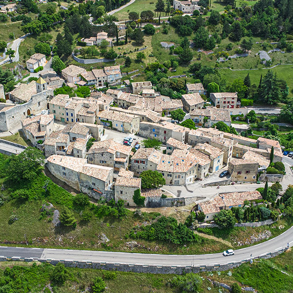
From the glazed tile spire of its square bell tower, Aurel spreads softly across the top of the gently curved hill on which it was built. The streets are pretty, with facades of bright orange stone. It is said that it has inspired the brushes of famous painters. Seyssaud is cited, Ambrogiani is mentioned. Aurel lives at the street level of the village, around its café, its fountain and its old washhouse. You can measure all its charm from the path leaving it for the Bois du Défends. In the shade of the tall coniferous trees that protect the pleasant forest path of the return route, we can digest a few hours of hiking exploring this trinity of Vaucluse villages humbly adjoining the Giant of Provence.

Did You Know?
While the Gorges de la Nesque are a spectacular natural site well known to visitors, it is less well known that the stream that crosses them has its source in Aurel where it once fed nearly twenty mills.
A pleasant escape into the hinterland of Sault, along easy paths that are little frequented, which connect two more beautiful specimens of Provençal villages with a mediaeval heritage: Saint-Trinit and Aurel. A charming hike in the world of the Ventoux.

David Genestal
Carnets de Rando
Hiking in Practice

To download:
– GPX track
– Data sheet for the hike


In detail:
– Distance: 16 km
– Elevation gain: 291 m
– Duration: 4 hours
– Difficulty: intermediate

By public transport:
From Carpentras train station, take 912 bus on the Zou Carpentras – Sault network (Crédit Agricole stop)
Access by car: Direction Sault, Gorges de La Nesque from Carpentras.