Venasque
V09 Venasque et le passage de l'Ascle
Route
Loop
Difficulty
Very easy
Duration
1h03
Distance
5km
Positive elevation gain
221 meters
Negative elevation gain
222 meters
Altitude
Min. 187 meters
Max. 308 meters
- circuit
- variante
- liaison
Departure / Arrival
Venascle - Place des tours / Venascle - Place des tours
Parking
Venascle - Place des tours
profil altimétrique
Downloads
Venasque et le passage de l'Ascle
Traces GPX
Tourist service in Venasque :
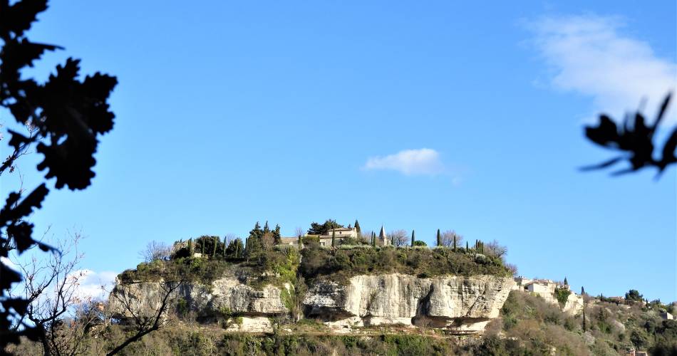
With your back to the car park, follow the route des Aires, heading for the “Complexe Sportif”. Take the 3rd little tarmac road (and not dirt) of Les Espuys (300 m before the tennis court) and go down into the bottom of the valley: after having gone along a large house, leave the route and follow the path opposite (yellow signposting) that goes downwards. At the little tarmac road, cross to follow the path, go around the remains of a windmill and go back up onto the road. Go around the climbing rock and go back up by the famous passage de l’Ascle which is like large staircases in the rock. At the top, the path changes direction towards the right (west) and joins a small road. At the “Jouvenal” sign, follow the small road to the right (views of the village on your right) which turns into a path, go along the rocky bars then go down towards the right, heading for Venasque (sign). Be careful when you’re coming down! At the road (Chapelle St Siffrein to the left), cross the road (be careful) and follow the path opposite that goes back up to the village. Go through the village centre to get back to the car park.Go to the route
public transportation
Nearest SNCF station: Carpentras
Transcove network
- From Carpentras: line N towards Venasque / Notre Dame de Vie stop
Maps, timetables and information on the Zou bus network.
Transcove network
- From Carpentras: line N towards Venasque / Notre Dame de Vie stop
Maps, timetables and information on the Zou bus network.
recommended parking
Venascle - Place des tours
road access
13 km south-east of Carpentras - via the D4.20 km north-east of Isle sur la Sorgue, via the D938, then the D28.
To note
Make sure you bring the right equipment with you (hiking shoes), water, and brightly coloured, weather-appriopriate clothing.
Hunting takes place from September to the end of February. Don't forget to find out about the battues before you leave.
Hunting takes place from September to the end of February. Don't forget to find out about the battues before you leave.
 If you want to report a problem on your hike (marking, maintenance, danger...), let us know on Suricate: sentinels.sportsdenature.fr
Access to the massifs
Respect the regulations preserving protected natural areas – find out about restrictions to accessing the massifs during fire risk periods, from 15 June to 15 September.
Before heading out, check the website
Respect the regulations preserving protected natural areas – find out about restrictions to accessing the massifs during fire risk periods, from 15 June to 15 September.
Before heading out, check the website
In brief
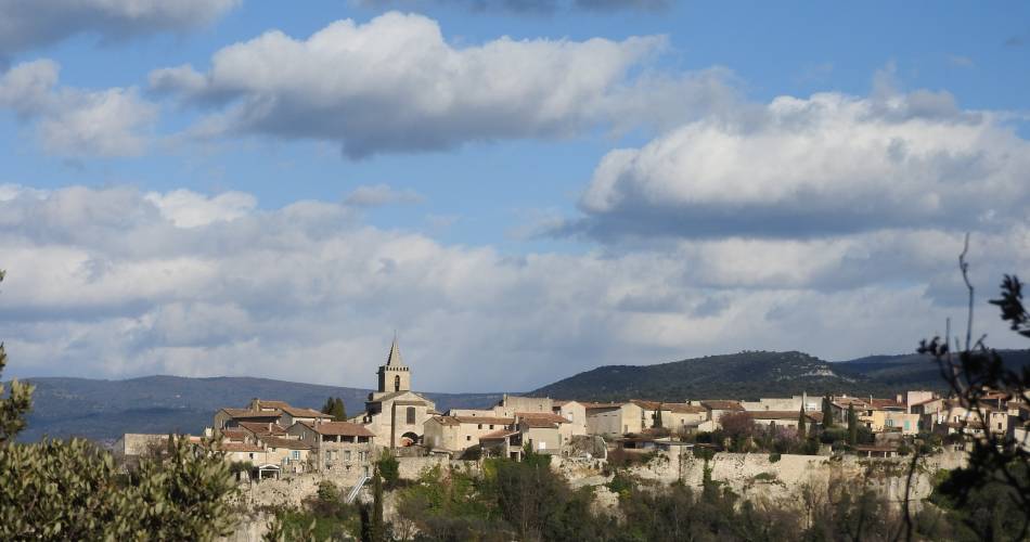
This trail enables you to discover the village of Venasque, classed amongst the most beautiful villages of France.Beautiful, unobstructed views of Mont VentouxA short and accessible family hike alternating between small roads, tracks and paths.Downloads
Contact
Ventoux Provence TourismeTel : View number 04 90 66 11 66
E-Mail : carpentras@ventouxprovence.fr
Website : https://www.ventouxprovence.fr
Guided hikes
This page was produced with the help of theOffice de tourisme Ventoux Provence Tourisme


