Malaucène
V02 L'écluse du Paty
Route
Loop
Difficulty
Difficult
Duration
4h
Distance
15km
Positive elevation gain
630 meters
Negative elevation gain
630 meters
Altitude
Min. 297 meters
Max. 698 meters
- circuit
- variante
- liaison
Departure / Arrival
Malaucène / Malaucène - Cours des Isnards
Parking
Route du Ventoux, or Grozeau spring
profil altimétrique
Downloads
Livret de la randonnée du lac du Paty
Fiche technique de la randonnée du lac du Paty
Traces GPX
Tourist service in Malaucène :
From Malaucène, follow the Route du Ventoux (D 974) as far as the crossroads of the Ne De du Groseau chapel, and head right following the GR 91 which climbs up to the Piaud chapel via the old Stations of the cross route. Join the D974, cross and ride down towards the Combe Obscure then climb again to pick up the GRP to the right which will bring you up onto the ridges and join the D19. Cross and turn right to pick up Les 3 Termes. Follow the route to the left until the Le Paty Chapel where you turn off to the right to ride down towards Le Paty lake. The GRP goes back up towards a small road that you cross. Then follow the PR as far as Font Mourèle, La Font de Pertus, Saint Michel (section on the D938, be careful!) and Malaucène.Go to the route
public transportation
Nearest train station: Carpentras (↗ |fr).
Bus Zou !
- From Vaison or Carpentras: route 911 / stops Bas (↗), Eglise (↗) or Palivettes (↗).
Transcove network
- Line K (↗ |fr) to Malaucène / stops Le Barroux Bas, Eglise or Palivettes
Bus Zou !
- From Vaison or Carpentras: route 911 / stops Bas (↗), Eglise (↗) or Palivettes (↗).
Transcove network
- Line K (↗ |fr) to Malaucène / stops Le Barroux Bas, Eglise or Palivettes
recommended parking
Route du Ventoux, or Grozeau spring
road access
At 18 km to the North of Carpentras, via the D938.
To note
- Plan to have good walking shoes.
- Sections via road, on the D938, on the way back. (7) and (1).
- White and red signposting from (1) to (3)
- Yellow and red signposting from (3) to (7)
- Yellow signposting from (7) to (1).
- Steep descents and paths obstructed by rocks.
 If you want to report a problem on your hike (marking, maintenance, danger...), let us know on Suricate: sentinels.sportsdenature.fr
Access to the massifs
Respect the regulations preserving protected natural areas – find out about restrictions to accessing the massifs during fire risk periods, from 15 June to 15 September.
Before heading out, check the website
Respect the regulations preserving protected natural areas – find out about restrictions to accessing the massifs during fire risk periods, from 15 June to 15 September.
Before heading out, check the website
In brief
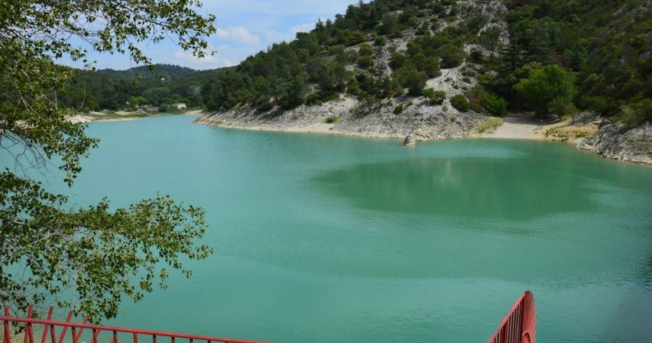
- The Le Paty lock (esclausa), which recently became Le Paty lake, is a nice circuit that combines passages along high-up crests, and vast outlooks.
- Le Paty means "public grazing".
- Discovery of the "chapelles de pluie" (rain chapels) like Pi-Au or Saint-Sidoine, which bear witness to a past when pilgrims took painful risks to get to them to ask for rain.
- Passes through undergrowth, among Austrian pines, box trees, and Aleppo pines.
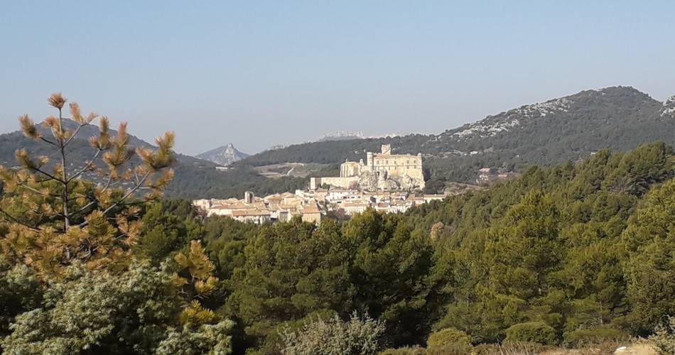
- Views of Le Barroux Castle, and Le Paty lake.
Contact
Fédération Française de Randonnée de VaucluseTel : View number 04 28 70 27 29
Guided hikes
This page was produced with the help of theOffice de tourisme Ventoux Provence Tourisme

