Saint-Léger-du-Ventoux
La randonnée de St-Léger-du-Ventoux par Terra Rando
Tourist service in Saint-Léger-du-Ventoux :
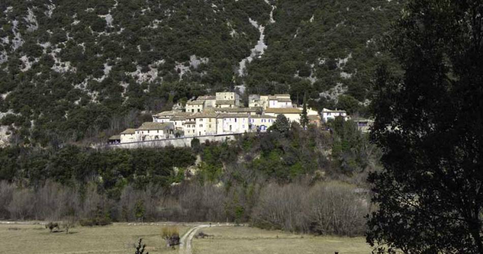
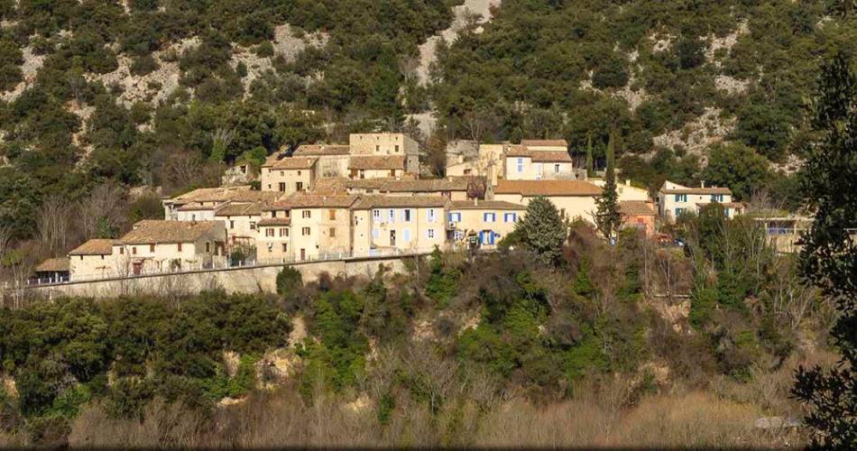
Discover the pretty little village of Saint-Léger-du-Ventoux in the Toulourenc Valley, facing Mont Ventoux.
A superb view of the Toulourenc gorges can be seen along the way. This easy hike takes in the northern slopes of Mont Ventoux. The botanical trail near the start of the circuit extends your discovery of the Saint-Léger-du-Ventoux terroir.
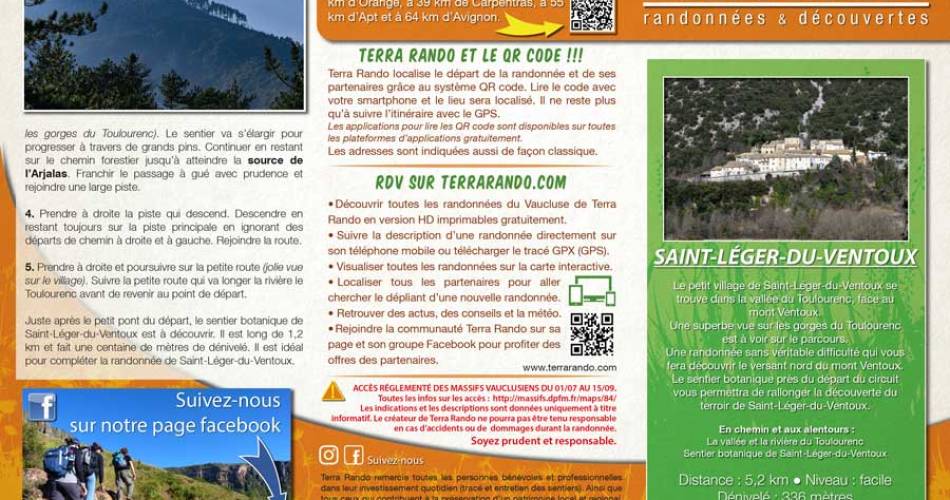
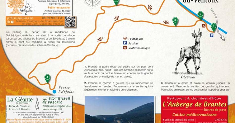
Distance: 5.2 km / Level: easy / Vertical rise: + 336 meters / Réf carte ©IGN : 3140ET.
To see along the way and around the hike :
> Toulourenc valley and river
> Saint-Léger-du-Ventoux botanical trail*: sun and water, from stream to garrigue...
(*The Saint-Léger-du-Ventoux botanical trail is available to download with the permission of its creator: the Toulourenc Horizons association)
You can obtain the hiking map free of charge from the Vaison Ventoux Provence Tourist Office.
Also on the terrarando.com website: advice on hiking in the Vaucluse and practical information from Terra Rando's partners. Happy hiking and discovering...
Services
- Pets welcome
Dates and times
From 01/01 to 31/12.
Languages spoken
- French
Prices
Free access.
Contact
La randonnée de St-Léger-du-Ventoux par Terra Rando84390 Saint-Léger-du-Ventoux
E-Mail :
Afficher le mail
terrarando@gmail.com
Website : https://terrarando.com/les-randonnees-du-vaucluse/randonnees-pedestres-mont-ventoux/la-randonnee-de-saint-leger-du-ventoux
Website : https://terrarando.com/les-randonnees-du-vaucluse/randonnees-pedestres-mont-ventoux/la-randonnee-de-saint-leger-du-ventoux
Coordinates
Longitude : 5.276512Latitude : 44.212283
> Getting there by public transport
Nearby
This page was produced with the help of theOffice de tourisme du Pays de Vaison Ventoux en Provence