Buoux
The Claparèdes plateau
Route
Loop
Difficulty
Easy
Duration
3h
Distance
9km
Positive elevation gain
81 meters
Negative elevation gain
81 meters
Altitude
Min. 558 meters
Max. 615 meters
Tourist service in Buoux :
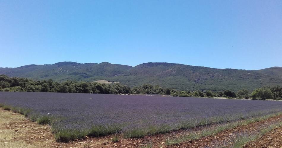
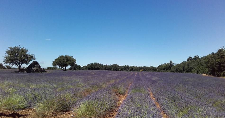
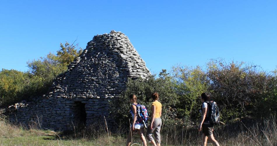
Colorful treasure in bloom and bead stripped out of season
"This short combination of paths between fields of lavandins, oak woods, dry lawns and juniper heaths, offers a beautiful multicoloured overview of the plateau Claparèdes. In the purple of early summer, the tones of autumn burn ... It is also an opportunity to appreciate the use of fieldstone for millennia and the construction of a large number of dry stone walls and bories. "Sophie Bourlon, responsible of studies Natura 2000 to the Luberon RNP.
Go to the route
public transportation
Bus Zou !
- From Pertuis or Aix en Provence: line 989 / Saignon Centre stop (↗).
Transport on demand: operates by reservation only. Remember to book your journey before 4.30pm the day before the journey and on Fridays for Mondays at the Apt bus station by calling +33 (0)4 90 74 20 21.
From Saignon Centre (↗), follow the GRP via rue de la Bourgade to reach the route (+ 4km return)
To note
 If you want to report a problem on your hike (marking, maintenance, danger...), let us know on Suricate: sentinels.sportsdenature.fr
Access to the massifs
Respect the regulations preserving protected natural areas – find out about restrictions to accessing the massifs during fire risk periods, from 15 June to 15 September.
Before heading out, check the website
Respect the regulations preserving protected natural areas – find out about restrictions to accessing the massifs during fire risk periods, from 15 June to 15 September.
Before heading out, check the website
Guided hikes
This page was produced with the help of theParc Naturel Régional du Luberon